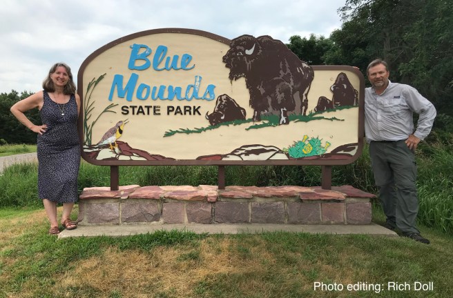
We decided to camp at Blue Mounds the evening before so we could get a nice early start on our hike. In fact, we had ambitiously decided that we would do two hikes on this trip: Split Rock Creek (2.6 miles) and Blue Mounds (6.2 miles). We figured we’d get in early on Saturday, hike SRC and then go over to Blue Mounds and set up camp. Things don’t always go according to plan.
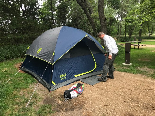
We ended up leaving late and decided to drive directly to Blue Mounds, set up camp, eat supper and do an early evening hike at Split Rock Creek before retiring for the evening in our cozy little tent. It was a hot, humid day with a heat advisory in effect, but even so, we thought it would cool down enough after supper to do the shorter hike. Things don’t always go according to plan.
Reality: We arrived at Blue Mounds late afternoon and found our campsite. It only took us ten minutes to set up our tent, but they were very meaningful minutes, imparting much wisdom and knowledge to us. I’m not sure where the phrase “sweating like a pig” came from, but it’s fair to say that we were living it out.
We sat down to rest our sweaty bodies and found that wonderful harmonious marital bliss of being in complete agreement: Split Rock Creek got crossed off the agenda. We drove into Luverne, got pizza and beer (mine was root), checked out the Wayside Chapel, Eagle Rock (the highest point in the park), and the bison viewing platform. We saw neither eagles nor bison.
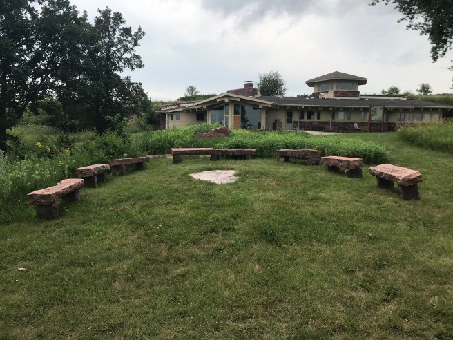
Eagle Rock actually is the place of the former home of Fred Manfred, an author who built the home back in 1960. A funny little tidbit about Manfred: he started out in life as Fred Feikema. His first novel, The Golden Bowl, was published under the name “Feike Feikema.” Clearly, he wanted to have some sort of repeating rhyming vibe to his pen name. I can just see him taking stock of things, pacing around a room murmuring “It’s not quite right – I think I can do better. What about Fred? Maybe I could use THAT name instead of Feikema for the repeating sound…something like Fred Manfred. Eureka!!”
The Manfred home is now an interpretive center, but it was closed. There was an interesting little rustic amphitheater there which was photo-worthy.
Amazingly, by the time we got back to the campsite, it was starting to cool down, which meant that it was not going to be the night of humid torment that I feared. We slept fairly well, although at one point my slumber was disturbed by loud snoring in the other cot. Usually I just gently shove the handsome offender onto his side and things get quiet. I was too far away for this maneuver, so I did the next best thing: I grabbed the huge tome I am reading (The Way of Kings by Brandon Sanderson) and poked him with it, which did the trick. He woke up enough to suggest that I should have brought my hiking poles in and used one of those for the prodding. He’s very thoughtful about these things, even if he didn’t remember making that suggestion the next day.
Look how much I’ve written and we haven’t even started hiking yet! Buckle up, people. My motto has always been: “Make a short story longer.”
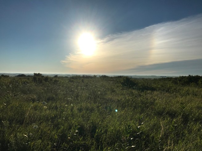
We hit the trail at 6:48 a.m., starting off with the sun still somewhat low to the horizon and temperatures around 60 degrees. Perfect!
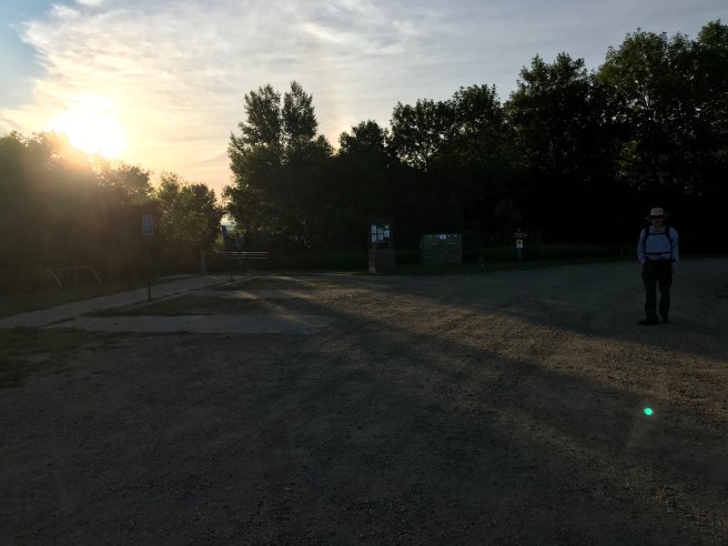
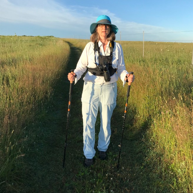
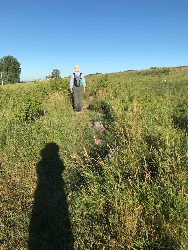
We needed to be able to finish the hike with more than usual speed because we still had a 2-hour drive to church afterward. We started off at a good clip, full of general joie-de-vivre and energy. It was the maiden voyage for my new sun hat and trekking poles, the latter of which I had hoped would help with knee stress.
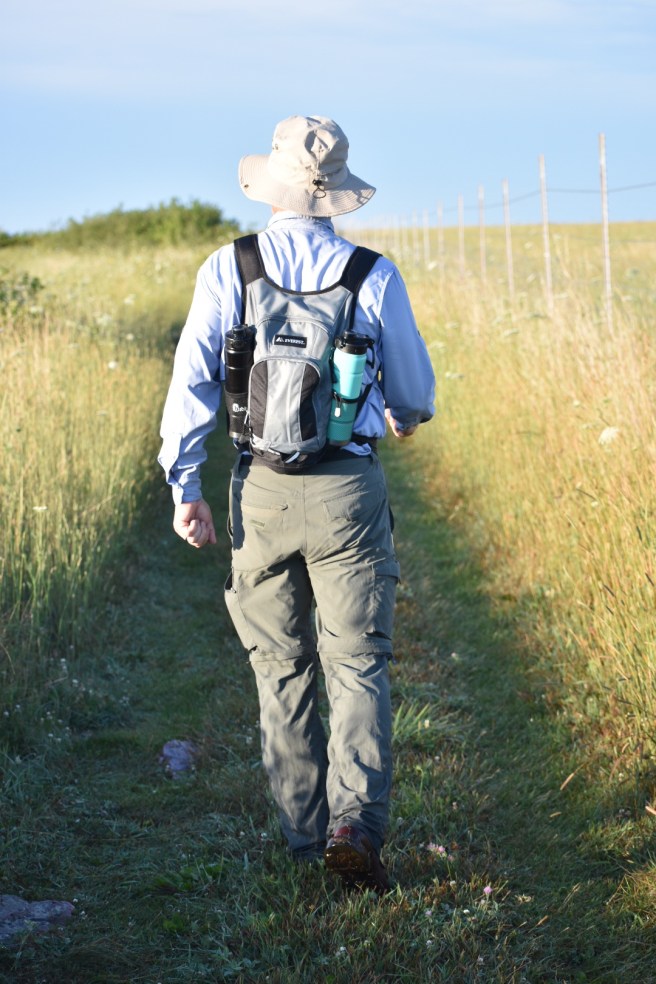
Our path was a nicely mown area through meadowy grasses and wildflowers.

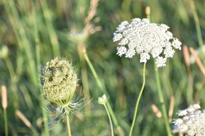
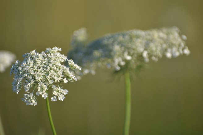
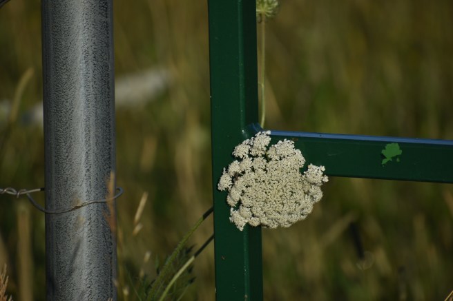
 Queen Anne’s Lace is in ascendency at this time of year and I took lots more photos of it than I will actually share here. Before it blooms, it looks like a closed umbrella, so I think it could as easily been called the Bumbershoot flower. That’s why I’m not consulted on these things.
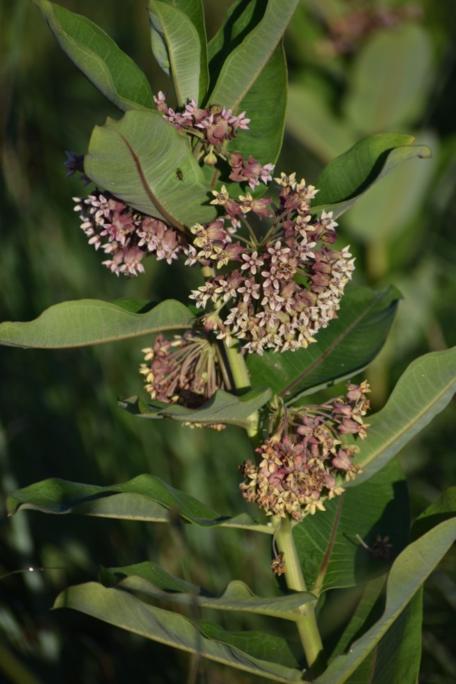
We also saw plenty of milkweed in the next phase of its growth. I checked under some leaves for monarch eggs or baby caterpillars but came up empty. They are all probably hiding in the same place as the elusive bison and eagles.
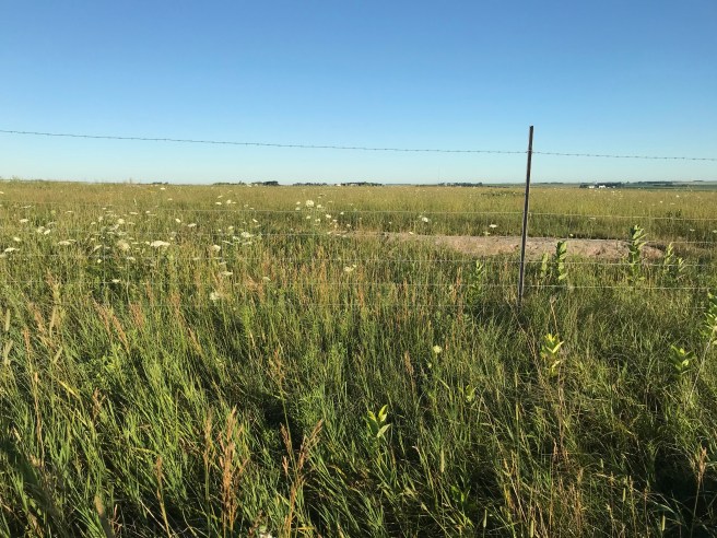
The first part of the hike takes you alongside the fence that separates us from the bison. The fence looks surprisingly wimpy – Kris observed that it definitely wouldn’t stop a determined velociraptor. Fortunately, they were all hiding, too.
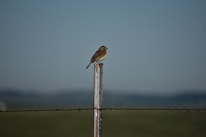
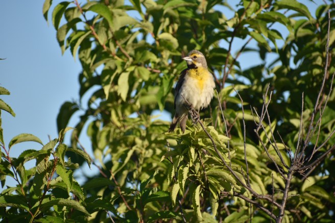
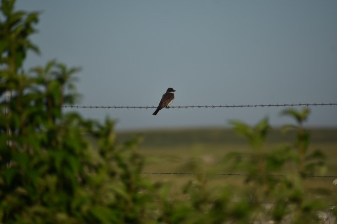
Many birds posed for me, which was a kindness I appreciated very much. Usually when we tromp noisily down a path, the birds are wise to our presence and refuse to come out for a photo. If our lives were a movie, I would have broken out in a song and dance routine (not unlike Snow White when all the woodland creatures gather around her. Oh, and we saw one of those, too. Probably singing, but we couldn’t tell.)
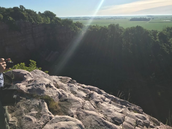
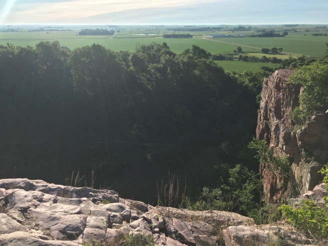
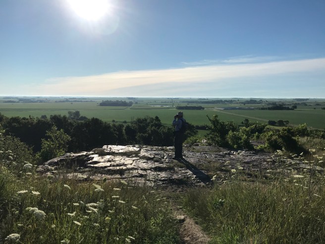
 About halfway through the hike, we were by the famous Sioux Quartzite cliffs of Blue Mounds. We walked over to take some photos, but I stayed well away from the edge due to the “fear of heights” thing. A sun beam showed up and gave a little extra sparkle to the view.
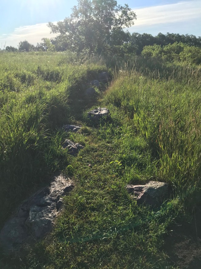
 We kept seeing notations on the maps for something called “Rock Alignment,” and this wasn’t descriptive for us to know exactly what this was or what we should be looking for. Had we already passed it and not known it? After the quartzite cliffs, we finally came across a sign with a description. It’s an alignment of stones and boulders that extends 1250 feet east to west, constructed of Sioux Quartzite. Nobody knows who made this line of stones, but everyone agrees that somebody built it. Kris commented that it was nice to see the park acknowledge that something that appears to have a design must have a designer. Boom!
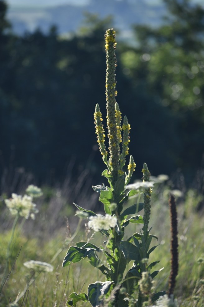
 The information on the map said to stay on the trails and watch out for prickly pear cacti, the spines of which can even pierce shoes. You don’t need to tell me twice. We saw something that reminded me of mini-saguaro cactus and I wondered if that’s what it was. If it’s not, I’ve got dibs on naming it “The Minnesota Saguaro.” [Later: I looked it up on Picture This. It’s Common Mullein. Oh well…]
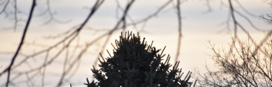
I know that people from mountainous areas find our small hills and flatlands to be uninteresting topography, but I love looking out over these areas where you can see so far into the distance. I thought the vistas of Blue Mounds were really lovely.
Most of the state parks we’ve been to have had a variety of trail areas: grassy meadows, dirt paths, forested parts, riverside trails, etc. Blue Mounds was pretty much the same kind of trail all the way through – a wide, mown path through the prairie. Works for me. Toward the end we walked past a large stand of sumac, which was about as forested as it got.


To our astonishment, we were done with the 6.2 mile hike at 8:34 a.m. How did we manage to walk that fast to get done in less than two hours? I was being very self-congratulatory about the whole thing – we are real hikers now! Kris stopped in at the office as we were leaving and found out that there’s an extra loop that got flooded and taken off the hike. We still get credit for 6.2 miles, but probably walked less than 5. I’ll take it. By the way, Blue Mounds State Park was established in 1961, the same year that my husband was established. It was a good year.

Final notes: About halfway through the hike, I reached my stride with using the trekking poles which were awkward at first to use, especially when I wanted to stop and take a photo. Blue Mounds didn’t really have a lot of up and down, which helped. I’m giving them a solid thumbs up.
Also, I had an inner playlist going on while we walked. For the first part of the hike, I was singing a song from My Fair Lady:
Just get me to the church,
Get me to the church.
Oh, get me to the church on time.
Towards the end of the hike, I had switched to the song from The Sound of Music about the lonely goatherd. Not sure what that was about, but it was stuck in my mind.
High on a hill was a lonely goatherd
(yodeling syllables)
Loud was the voice of the lonely goatherd
(more yodeling syllables)
This was our 25th State Park on the Park Passport, so we were awarded with a certificate for a free night of camping to use sometime later. Also, we got our 50-mile patch for the Hiking Club. It was a banner day.

AND…we got to the church on time!
Knee score: 1-2. Fairly even ground, long hike. We’re at 71.5 miles total.
I’ll probably delete this in the morning.
Next Hike: Temperance River State Park

One thought on “Blue Mounds State Park: A Banner Day”