This is the last in the series, although we certainly hope to visit more national parks. For the beginning of our Southwest Tour, start here: Arches National Park
We got an early start in the morning, hoping to get to Zion NP before it got crowded. We reached the park around 8:00 a.m. and the parking lot was already full. We had to turn around and find a parking spot in Springdale, the prosperous town that makes a lot of money off tourists, no doubt. The first place we found was $30, so we rejected that and drove further away, finally find a roadside spot for $15. The shuttle buses come along every 10-15 minutes and pick up tourists (for free) to drive them into the park, so we did that.
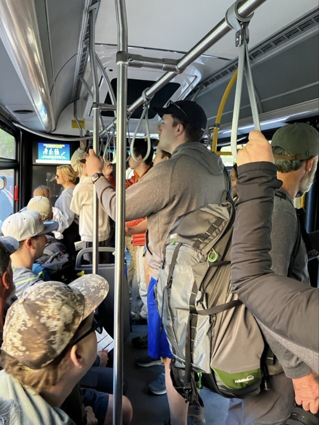
Once in the park, we stopped at the Visitor Center to get our passport and book stamped and then hopped on a shuttle bus to go to one of the stops along the way. The buses were all super crowded.
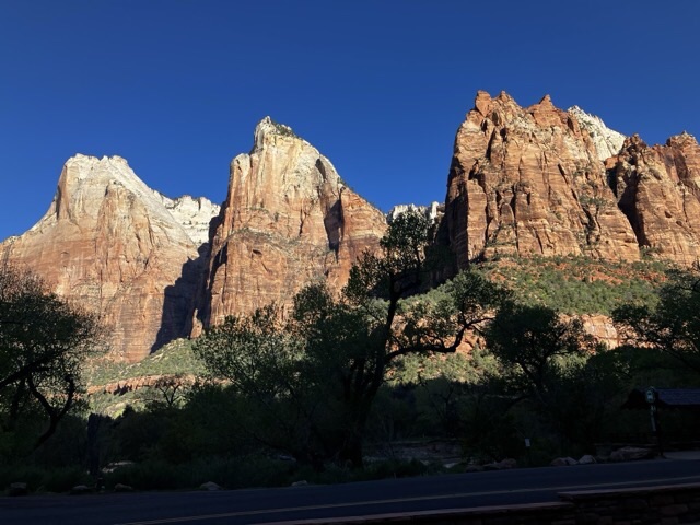
Up until now we haven’t seen huge crowds at the parks we’ve gone to, but Zion was packed. The first stop was “Court of the Patriarchs,” where very few people got off, making us wonder if we were chumps. The patriarchs are three distinct stone cliffs that a Methodist pastor named “Abraham, Isaac and Jacob,” back in the early 1900’s. The names have stuck. Photos were taken. There was a smaller formation that was named “Moroni.” The Christians won that round over the Mormons. We walked around a little bit – went down to the Virgin River, but quickly realized that there wasn’t much to see there. Chumps.
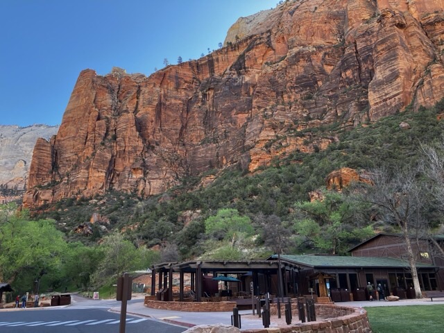
The next shuttle took us to Zion Lodge, where the bus driver gave directions for finding the hike to see the “Emerald Pool.” We set off across the street and wondered why we were the only ones interested in the hike, especially in view of the numbers of people there. When we got up to the bridge over the river, it was closed. Chumps.
Back to the lodge, we waited for another shuttle to take us up to the Sinawava Temple area, which is the last stop on the shuttle bus tour. A shuttle bus came, passed our little group waiting for the bus and parked ahead of us. And it was nearly empty, which was a plus – but no one in the group went to go get on. One couple meandered over and got on, so we finally went over as well. Once on the bus, Kris asked why this shuttle parked so far ahead of the other bus stop – was there a difference? Yes, this one was going back down the road to the Visitor Center. We got off and went back to the other line. Chumps.
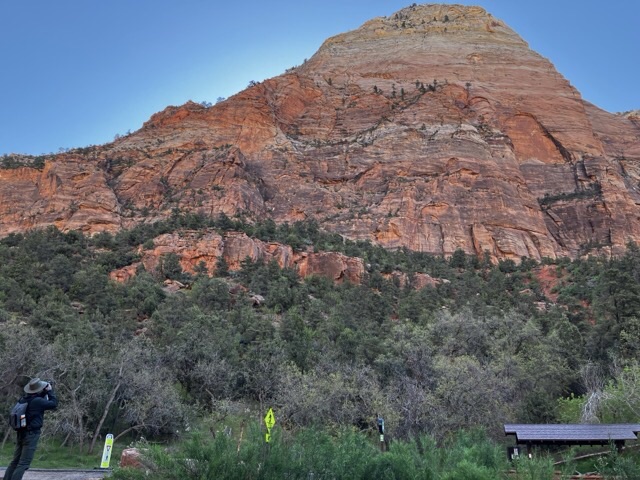
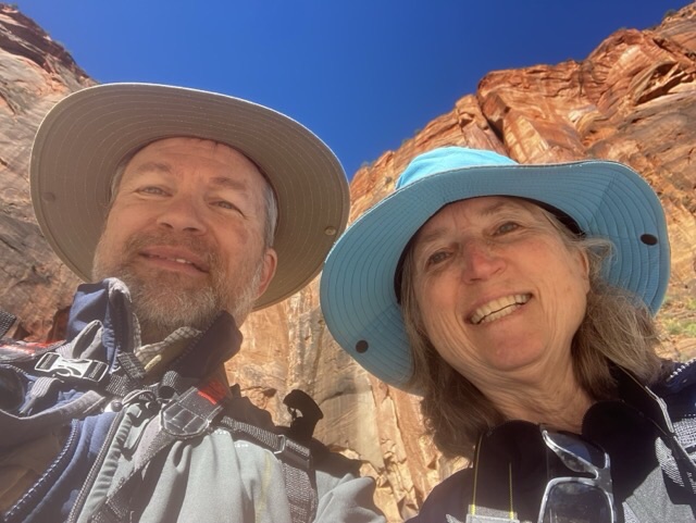
The shuttle to Sinawava Temple was super crowded – standing room only. We never did find out why the area was named Sinawava Temple, but Kris guessed that it was because the surrounding stone cliffs were so high and close and surrounded us, which gave a feeling of being in a church. I’ll buy that. There was a hike up to the Narrows that we walked for part of the way. We took photos, but the surroundings were so immense that photos will never tell the whole story.

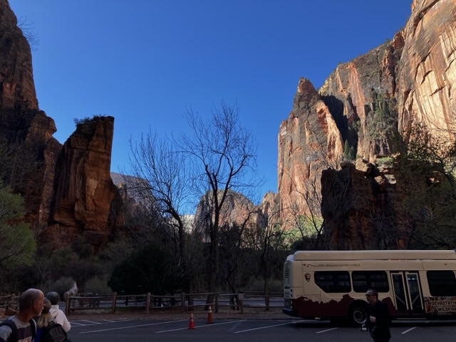

We decided that we didn’t need to take the hike all the way to the Narrows – we could sort of see it from where we were, so we headed back and took the next shuttle down as far as the museum. The shuttle wasn’t very crowded so I sat up by the front. Kris seemed to want to sit farther back, but I told him this way he could chat up the bus driver. He looked dubious about this prospect, but of course he did chat him up, asking all sorts of questions about the electric buses and how long the batteries on those last. The electric buses each cost $1 million dollars!
The museum was minimally interesting – little bits of information about the early inhabitants of the area: the Native Americans and the Mormans. We strolled around and got on the next shuttle to go back to the Visitor Center. Amazingly, it was noon by the time we left. From the Visitor Center we took a shuttle back to our car and ate our familiar lunch of Wheat Thins, Swiss cheese, and grapes. Kris wanted to drive the road to the east entrance through the park so we did that after we finished eating.
That drive (Highway 9) was stunning and spectacular – I wish I could have enjoyed it more. I felt a little uneasy about the drop offs along the way. I mean, I did enjoy the drive, but with some degree of nervousness. There were a few hairpin turns at the beginning and the road went steadily up from around 3900 feet of elevation to almost 6000 feet at the top. Fairly early on there’s a a couple tunnels, the first one being 1.1 mile long.
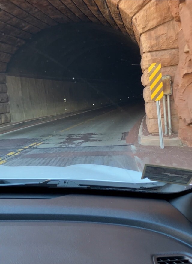
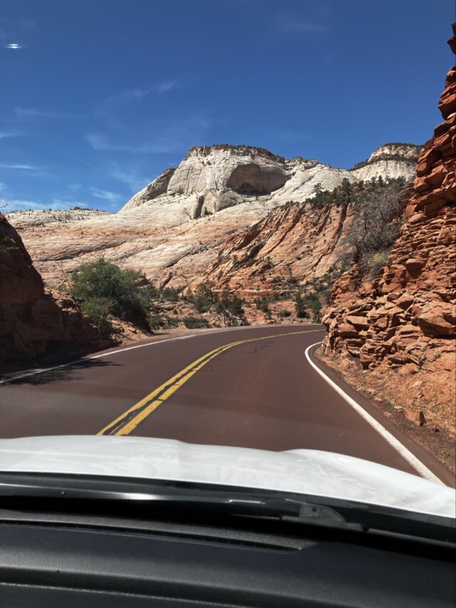
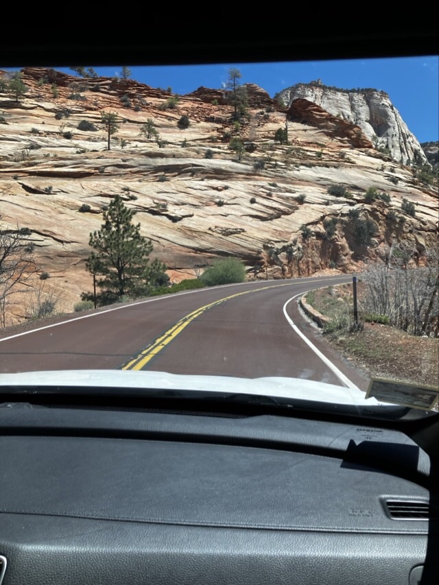
Fat cars had to pay an extra $15 to drive on this road because the park personnel have to restrict the cars to one lane going through at a time when the fatties go through. The first time through the tunnel, we whizzed on through, but on the way back, we had to wait close to 10 minutes for fatties coming through from the other way. It took us about an hour to do the round trip of going to the top and coming back. We stopped a couple times to enjoy the view and take a couple photos. The feature near the top is called “Checkerboard Mesa,” and you could see a large sandstone hill with markings on the side that looked similar to a checkerboard pattern. More photos were taken.

Now you know what to expect if you go there, which you definitely should!
I’ll probably take this on the crowded electric blog bus in the morning.

The “fatties” are really “tallies”—vehicles like delivery trucks and RVs that have to drive down the center of the tunnel that is cylindrical and has low sides, but just enough clearance in the middle. Clearly the engineers did not anticipate this in their design. But it was quaint and a reminder that one is on vacation in a very rugged terrain. No complaints!!
—Ranger Cornelius VanRocksliden
LikeLiked by 1 person
I’m going to stick with fatties cuz I like it better, but you’re right, they were “tallies.” I wasn’t paying enough attention!
LikeLike